
Remote Coastal Water Quality Monitoring for Estuaries and Aquaculture
A coastal water-quality station can fail quietly. A probe grows a film of algae, a tide leaves a sensor in air, salinity swings beyond the sensor range, or a modem loses signal during bad weather. The dashboard may still show numbers, but the data no longer describes the water.
Remote monitoring in estuaries, shellfish beds, fish farms, harbors, and nearshore sites needs more than dropping a sensor into the water. Coastal systems move, foul, corrode, stratify, flood, and shift with tides. A good system accounts for those forces from the start.
The goal is simple: collect trustworthy measurements often enough to see change, with equipment that can survive the site.
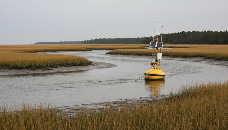
Start with the question the data must answer
Sensor selection should begin with the management question, not the instrument catalog. A station for harmful algal bloom early warning has different needs than one used to check dissolved oxygen near net pens.
Common questions include:
Is dissolved oxygen dropping overnight?
Does salinity change after rain, river flow, or tidal exchange?
Are turbidity spikes linked to dredging, wind, or storm runoff?
Does water temperature exceed stress thresholds for stocked species?
Are pH and conductivity shifting in a way that suggests freshwater pulses or acidification risk?
Is chlorophyll rising before visible bloom conditions develop?
A clear question shapes the whole design. It sets the sampling interval, accuracy needs, cleaning schedule, telemetry requirements, and mounting method.
For example, a weekly spot reading may miss a severe dissolved oxygen drop before dawn. A sensor logging every 15 minutes can catch the dip, show how long it lasted, and help separate a one-time event from a repeating pattern.
Choose sensors that match coastal water, not just clean water
Coastal water is hard on instruments. It contains salt, suspended sediment, plankton, organic matter, bubbles, and sometimes oil or debris. The right sensor should suit the parameter, expected range, fouling pressure, and service interval.
Parameter | Why it matters | Coastal field notes |
Temperature | Controls oxygen solubility and biological stress | Usually stable to measure, but probe placement matters near surface heating |
Conductivity and salinity | Shows freshwater mixing, tidal exchange, and stratification | Use a range suitable for brackish to marine water if the site changes often |
Dissolved oxygen | Critical for fish, shellfish, and benthic life | Optical sensors are common for long deployments, but still need cleaning |
pH | Tracks biological activity and acidification stress | Needs careful calibration and more maintenance than many operators expect |
Turbidity | Indicates sediment, resuspension, runoff, and disturbance | Wipers help, but bubbles and biofilm can distort readings |
Chlorophyll or blue-green algae | Helps flag bloom conditions | Fluorescence readings can be affected by light, species mix, and suspended solids |
Water level or pressure | Connects readings to tidal stage and depth | Venting, barometric correction, and mounting elevation need attention |
Do not buy every sensor because it is available. Each extra parameter adds cost, power use, calibration work, and possible failure points. A lean station that measures the right four parameters well often beats a complex station that no one can maintain.
Optical sensors often fit remote sites
Optical dissolved oxygen, turbidity, chlorophyll, and fluorescent sensors are widely used in remote coastal systems because they can log frequently and avoid some issues found in older wet-chemistry methods. They still need validation. Optical windows foul, wipers wear, and sunlight or bubbles can affect some readings.
pH and salinity need extra respect
pH sensors can drift, especially in warm, biologically active, or fouling-prone waters. Salinity looks simple, but conductivity cells can foul or trap air. In estuaries, values can shift quickly with tide and rainfall, so the sensor range and calibration standard should match the site.
Design around tides, depth, and salinity changes
Tides turn a fixed monitoring point into a changing environment. At high tide, a sensor may sit several feet below the surface. At low tide, it may sit near the bottom, in warm shallow water, or even out of the water if the mount is too high.
That matters because water quality can vary by depth.
In an estuary, freshwater may ride on top of denser saltwater. Dissolved oxygen can differ near the bed. Turbidity may spike near the bottom when currents resuspend sediment. A sensor at one fixed depth tells the truth about that depth, not the entire water column.
Good site planning includes:
Tidal range
Confirm the highest and lowest expected water levels, including seasonal extremes and storm tides.
Sensor depth
Decide whether the sensor should track near-surface water, bottom water, or a fixed elevation.
Stratification
Use profile measurements during setup to see whether temperature, salinity, or oxygen changes with depth.
Exposure risk
Make sure probes stay submerged, unless the system is designed to detect exposure and flag bad data.
Current speed
Fast currents can vibrate mounts, move cables, and carry debris into the station.
If the site stratifies, one sensor may not be enough. A shellfish farm may care most about the water flowing across the crop. A fish cage may need sensors inside the cage and upstream of it. A restoration site may need bottom oxygen, not just surface readings.

Plan for fouling before it ruins the data
Biofouling is one of the main reasons coastal monitoring data goes bad. Algae, bacterial films, barnacles, mussels, silt, and slime can coat sensor faces and protective cages. A sensor may drift slowly, so the data looks believable until someone checks it.
Antifouling is a system design issue, not a single accessory.
Common defenses include:
Copper guards or copper tape near sensor faces
Mechanical wipers on optical windows
Smooth surfaces that are easier to clean
Shaded mounts that reduce algae growth
Shorter service intervals during warm seasons
Duplicate sensors for critical measurements
Data checks that flag sudden jumps, flatlines, or impossible values
Fouling pressure changes by season. Warm water, high nutrients, and sunlight often speed growth. Aquaculture sites can foul quickly because farm structures provide surfaces for marine life. After storms, sediment and debris can cover a sensor even when biofouling is modest.
A practical maintenance plan should answer three questions:
How long can the sensor stay in the water before drift becomes unacceptable?
Who will clean and inspect it?
How will the team know when readings are no longer credible?
Field logs help. Record the condition of each sensor before cleaning, take a reference reading if possible, then record the reading after cleaning. That pattern builds site-specific knowledge.
Mount sensors for clean flow and safe service
Mounting looks like hardware work, but it controls data quality. A probe in stagnant water, turbulent bubbles, or direct sunlight may read differently from the water body around it.
Good mounting keeps sensors:
Submerged through the target tidal range
In representative water flow
Away from prop wash, drains, dead zones, and cage shadows unless those are the target
Protected from debris and boats
Easy to reach for cleaning
Secure enough to withstand storms and current
For estuaries, common options include fixed piles, bridge mounts, floating buoys, dock frames, and bottom frames. Each has tradeoffs.
Mount type | Best use | Watch for |
Fixed pile | Stable depth reference and easy access | Sensor may be too shallow at low tide or too deep at high tide |
Floating buoy | Tracks surface layer as water rises and falls | Motion, vandalism, and mooring wear |
Dock or pier mount | Simple service access | Local effects from shade, boats, and poor circulation |
Bottom frame | Near-bed oxygen, turbidity, and salinity | Burial, trawling, debris, and hard retrieval |
Aquaculture structure | Directly measures farm conditions | Biofouling, gear movement, and feeding effects |
Cable protection matters too. Use strain relief, avoid tight bends, and keep connectors above splash zones where possible. Saltwater finds weak points. A cable that rubs on metal during every tide can fail long before the sensor does.
Calibrate for the field, not just the manual
Calibration keeps sensors honest, but remote sites need more than a lab routine. Coastal stations need pre-deployment checks, field verification, cleaning records, and post-deployment checks.
A useful workflow looks like this:
Inspect the sensor
Check membranes, optical windows, wipers, O-rings, connectors, and guards.
Calibrate in clean conditions
Use fresh standards and follow the sensor maker’s procedure.
Record calibration details
Note date, time, standards, temperature, operator, and any concerns.
Take a field comparison
Use a handheld meter, grab sample, or reference probe at deployment.
Check after recovery
Read the sensor before cleaning, clean it, then read it again.
Correct or qualify data
Flag drift, fouling periods, out-of-water periods, and known service events.
Never treat calibration as a paperwork step. It is how raw numbers become defensible data.
Dissolved oxygen checks may use air-saturated water or water-saturated air, depending on the instrument. pH calibration normally uses buffer solutions near the expected range. Conductivity standards should match the salinity regime. Turbidity checks need care because particles settle and standards can be sensitive to handling.
For aquaculture and regulatory programs, data review should be routine. A simple graph can reveal sensor drift, tidal patterns, fouling, battery issues, or communication gaps.

Power systems must survive long gaps between visits
Remote coastal stations often run where grid power is unavailable. Most use batteries, solar panels, or both. The right power design depends on sensor load, logging interval, telemetry use, climate, shading, and service access.
The main loads are:
Sensors and wipers
Data logger
Modem or radio
GPS if used
Camera if included
Heating or special equipment in cold sites
Telemetry can use more power than sensing. A station that transmits every few minutes needs more energy than one that sends a packet twice a day. If the site only needs daily review, less frequent transmission can extend battery life.
Solar is common, but coastal solar has its own issues. Salt spray clouds panels. Birds perch on frames. Fog, storms, and short winter days cut output. Panels need enough tilt and height to shed grime and reduce shading, but they must not make the station unstable in wind.
A good power budget includes a safety margin. It should account for the lowest solar period of the year, not the best week in summer. For critical stations, use low-voltage cutoffs and alerts before the system dies.
Communications need a backup plan
A remote sensor is only useful if the data reaches someone in time to act. Coastal communications can use cellular, radio, satellite, Wi-Fi from a nearby structure, or manual downloads.
Cellular works well in many nearshore areas, but signal strength can change with antenna height, carrier coverage, weather, and terrain. Aquaculture sites in protected bays may sit just outside steady coverage. A high-gain antenna can help, but it must be mounted and sealed carefully.
Radio links can work across line of sight, especially between a station and shore base. Satellite fits remote areas, though it costs more and may send smaller data packets.
The choice depends on urgency:
Data need | Suitable communication pattern |
Early warning for low oxygen | Frequent telemetry with alerts |
Long-term trend monitoring | Daily uploads may be enough |
Compliance reporting | Reliable logs plus documented data checks |
Research deployment | Onboard logging with periodic downloads may work |
Remote aquaculture operations | Near real-time data and alarms often help |
Build alarms with care. Too many false alarms train people to ignore them. Set thresholds based on the biology, site history, and sensor accuracy. Use alert delays where appropriate, such as requiring several bad readings in a row before sending an oxygen alarm.
Turn raw readings into quality-controlled data
Remote systems produce a lot of numbers. Without quality control, the number of readings can create false confidence.
Useful checks include:
Range checks for values outside physical limits
Rate-of-change checks for sudden jumps
Flatline checks for stuck sensors
Tidal comparison to expected rise and fall
Battery voltage and internal temperature review
Cross-checks between salinity, depth, and tide
Service-event flags for cleaning and calibration
Coastal data often shows strong natural cycles. Dissolved oxygen may rise during the day as photosynthesis adds oxygen, then fall overnight. Salinity may pulse with each tide. Turbidity may climb during strong winds or spring tides.
Quality control should protect those real signals, not smooth them away. The aim is to separate environmental change from sensor error.

Match the station design to the site
Estuaries, aquaculture sites, and open coastal environments share challenges, but they need different design priorities.
In an estuary, tidal mixing and freshwater inflow often drive the signal. Put effort into depth, salinity range, and water-level context. A single storm can change water quality for days.
At an aquaculture site, biology and operations matter. Feeding, stocking density, biofouling on nets or gear, and water exchange all shape readings. Dissolved oxygen sensors should sit where they reflect animal exposure, not just open water nearby.
In a coastal harbor or nearshore site, waves, navigation, vandalism, and debris may dominate the design. Hardware needs protection, and the station may need permits or marking so it stays safe around vessels.
A good system fits the location rather than forcing one standard package into every site.
What a reliable coastal monitoring setup includes
A dependable remote station usually has these pieces working together:
Sensors matched to the question and salinity range
A mount that keeps probes in representative flow
Antifouling tools and a realistic service schedule
Calibration records before and after deployment
Power sized for the worst season
Communications suited to the urgency of the data
Local data storage in case telemetry fails
Alerts that people trust
Quality-control rules built into review
Clear field logs for every visit
The best designs are simple enough to maintain. They do not remove fieldwork. They make each field visit more useful.
Remote Coastal Water Quality Monitoring for Estuaries and Aquaculture works when the system respects the water it measures. Tides, salinity, fouling, power limits, and communications gaps are not afterthoughts. They are design conditions.
Build for those conditions, and the station can do more than collect data. It can show when the water is changing, when animals are at risk, and when a field team needs to act.


Comments